Your Topographic Survey. Done in 72 Hours.
LiDAR-grade aerial surveys for construction projects across Costa Rica. Centimeter-accurate 3D data — delivered faster and cheaper than traditional surveying.
Get a Quote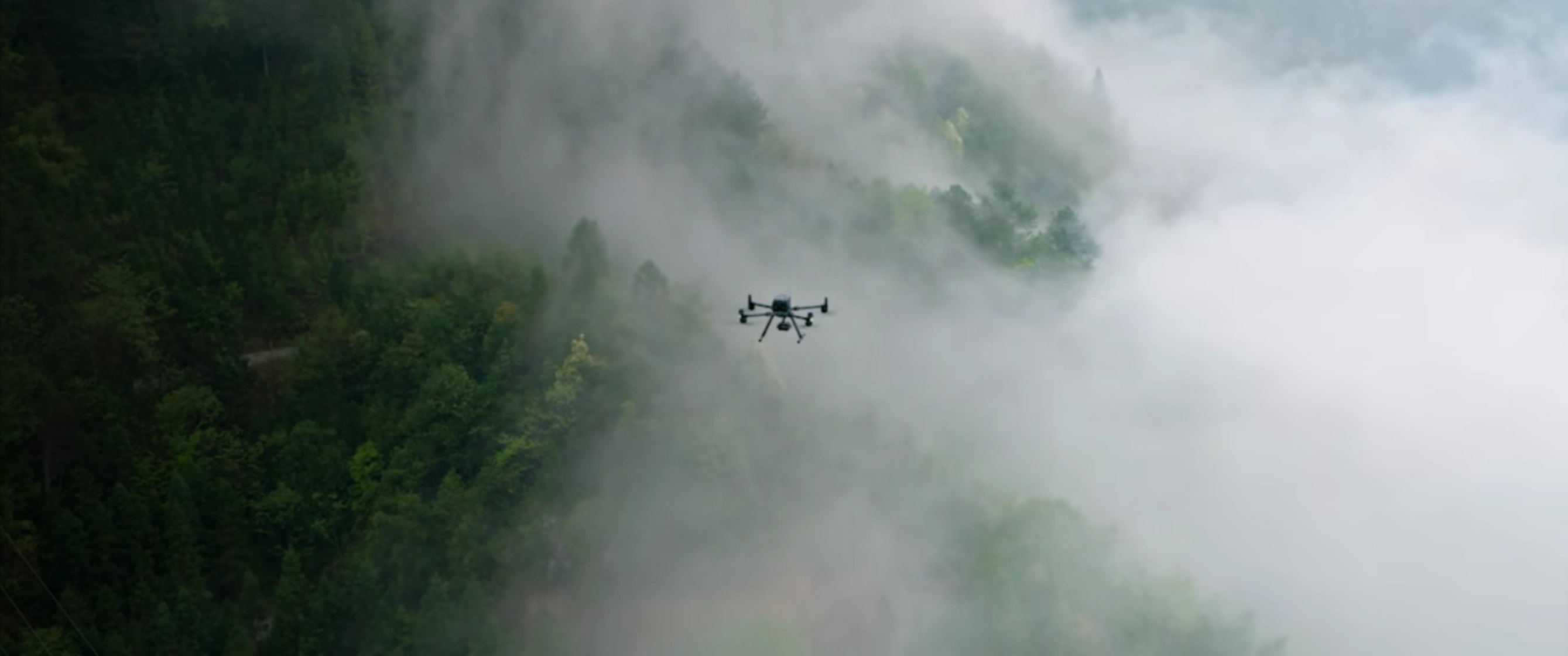
Traditional Surveys Are Slowing Down Your Projects
Bad survey data — or delayed survey data — is one of the top causes of construction cost overruns in Costa Rica. Here's what your team is risking right now.
Weeks of Waiting
Traditional ground surveys take 2–4 weeks. Your project timeline can't afford that delay.
Costly Rework
Inaccurate topographic data leads to wrong cut-and-fill calculations, bad drainage, and expensive redesigns.
Inaccessible Terrain
Costa Rica's slopes, jungle, and irregular terrain make ground surveys dangerous and incomplete.
Dispute Risk
No proper aerial documentation means change order disputes are harder to win — and more costly to lose.
LiDAR Drone Surveys — Built for Construction
Centimeter-accurate 3D data ready for AutoCAD, Civil 3D, and Revit. Every project includes the deliverables your engineers actually need.
- LiDAR Point Clouds — Millions of laser-measured data points. Centimeter-accurate 3D representation of your entire site.
- Digital Elevation Models (DEM) — High-resolution elevation data for cut-and-fill calculations, drainage design, and grading plans.
- Orthomosaic Maps — Georeferenced aerial imagery stitched into a single accurate map — perfect for planning and documentation.
- Contour Maps — Auto-generated contour lines at your specified interval. Import directly into design software.
- Progress Monitoring Reports — Regular aerial site documentation for phase tracking, client reporting, and change order protection.
From Inquiry to Delivered Data in 4 Steps
1. Send Us Your Project Details
Location, site area, and what you need. WhatsApp or online form — your choice.
2. Get a Same-Day Quote
We'll send you a custom quote, usually within a few hours of your inquiry.
3. We Fly Your Site
Our team arrives with LiDAR-equipped drones and completes the flight mission — typically in a single day.
4. Receive Your Data
Processed deliverables — DEMs, point clouds, orthomosaics — delivered within 72 hours of the flight.
What Construction Teams Use Us For
Pre-Construction Surveys
Full topographic data before breaking ground — so your engineers design on accurate terrain.
Cut & Fill Calculations
Precise volume data for earthworks planning and material cost estimation.
Drainage & Grading
Real elevation models that reveal drainage paths and grading requirements before you pour concrete.
Progress Documentation
Weekly or monthly aerial photo/video documentation for client reports and dispute protection.
Site Boundary Mapping
Accurate boundary surveys overlaid on georeferenced imagery — no more manual GPS walks.
Steep Terrain Surveys
Safe aerial data collection on slopes, forests, and sites too dangerous for ground crews.
Faster, Safer, More Accurate Survey Data
Construction teams across Costa Rica trust us for centimeter-accurate LiDAR data delivered in days, not weeks. Our DJI Matrice 350 RTK platform paired with the Zenmuse L1 sensor captures 240,000 points per second, penetrating dense canopy to map the true ground surface beneath. We serve all of Costa Rica — from Guanacaste to the Caribbean coast — and handle the required DGAC flight permits.
72-Hour Turnaround, Centimeter Accuracy
Typical delivery in 72 hours · ±1–3 cm LiDAR accuracy · 50+ projects completed · 7+ years in Costa Rica · 5.0★ across 25 Google reviews. Read all 25 reviews on Google →
Trusted by Property Owners & Professionals Across Costa Rica
⭐⭐⭐⭐⭐ 5.0 out of 5 · 25 Google reviews
"Outstanding service and professionalism. The drone survey provided exactly what we needed for our project — accurate, detailed, and delivered on time."
— Travis Comstock
"Excelente trabajo. Los datos que recibimos fueron muy precisos y nos ayudaron enormemente en la planificación del proyecto."
— Javier Mora Balma
"Professional team, incredible results. The topographic data saved us thousands of dollars in planning costs. Highly recommended."
— Marco Corvetto
Get a Free Quote for Your Project
Tell us about your construction or development project and we'll send you a custom quote — usually the same day.
Prefer WhatsApp? Message us directly: +506 7293 8970
Ready to Survey Your Site?
Get centimeter-accurate topographic data for your construction project — in 72 hours.